Tropical Volcanic Island Hex Map
John Eckelkamp
Our school’s elementary students have a Geography Fair every year, similar to a Science Fair but where they research a country and share what they have learned instead of doing a science project. Three-dimensional maps and models of important structures are popular parts of their displays. I decided to purchase Hot Wire tools so that I could experiment with them and then teach the children how to use them for their projects.
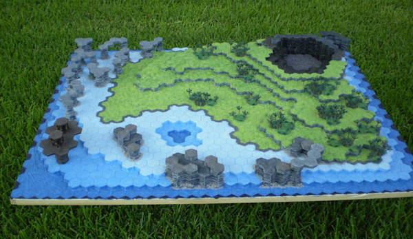
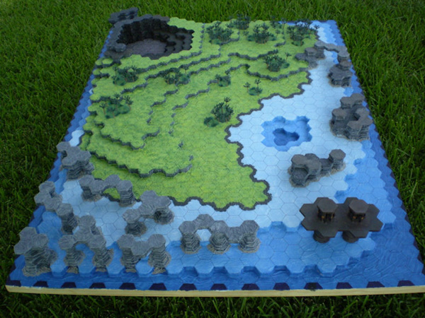
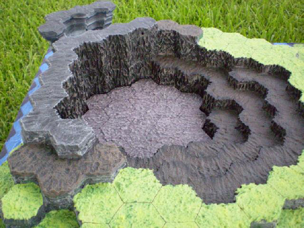
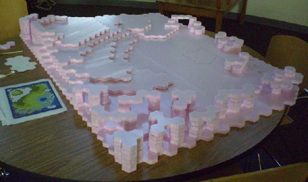
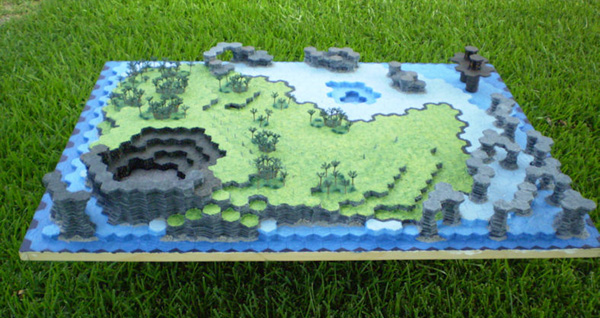
For my practice project I decided to build a relief map of a volcanic island based on hexagons that I could use with a game I play on weekends. We used sheets of extruded polystyrene foam insulation panels available at local hardware stores. With the exception of a small research platform in one corner and the cooled lava plug in the volcano, the entire map was made of sculpted foam. Using templates made of poster board, we were able to use the Hot Wire Scroll Table to easily cut out the complex shapes of each map layer.
After much experimenting and talking with adhesion specialists at 3M, I settled on using their Super 77 spray adhesive to bind the layers together. It has the advantages of being easily available and working well with laminating our large flat layers together. 3M had other products that would have worked that were more environmentally friendly, but they were only available in costly five gallon buckets. For our purposes, PVA glue, like Elmer’s, was not an option. PVA glue needs to evaporate to dry and that means that only the outer inch or two of our layers would have dried. The inner parts would have been sticky, but the glue would have remained liquid. I have seen cases where PVA glue used in layers like this was still liquid when the project was pulled apart over five years later.
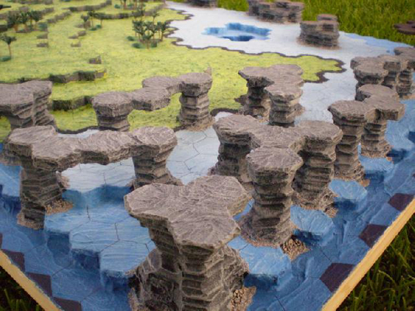
The Hot Knife tool came in handy for cutting out the interior voids of our layers where the lagoon and volcano were. Once the layers were adhered to each other, we used the Freehand Router bent to match the hexagonal contours to sculpt the cliffs and other rock formations into more eroded shapes while maintaining the hexagonal theme. We then softened all the edges with the Engraving Tool. The Engraving Tool also proved to be excellent at reproducing the slightly melted effect of cooled lava surfaces. By rapidly dragging the tip and sides of the engraving tool across the surface of the foam, we could partially melt and smear the surface to get the desired effect. We used this effect extensively across the map on our exposed rock.
Our project was a great success and gets lots of attention whenever we pull it out. We already have plans for making more maps and I cannot wait to start teaching our students to use these tools. For more on this project, including detailed start to finish photos, see the original forum post at https://www.terragenesis.co.uk/forum/viewtopic.php?t=5610